Spatial Access to Diabetes Intervention for Guyanese Immigrants in Schenectady, New York

April 25, 2014
epidemiology GIS Schenectady chronic disease Diabetes health care delivery

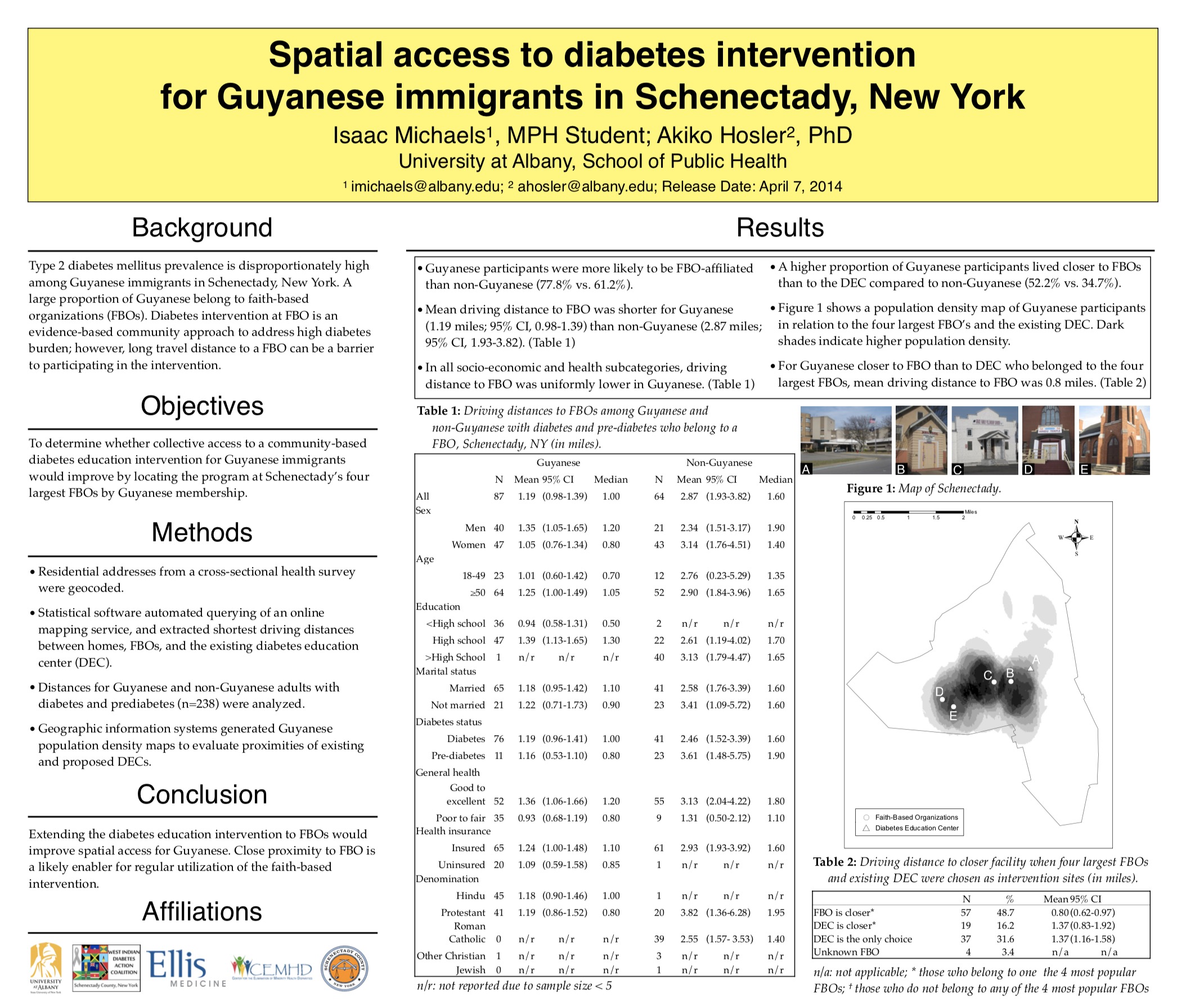
The following poster (pdf) was presented by Isaac H. Michaels, MPH at the 23rd annual University at Albany School of Public Health Student Poster Day in Rensselaer, New York on April 25, 2014. It was awarded the HRI David Axelrod Award, Top Mention for Excellence in Research. The poster is based on research by Akiko S. Hosler, PhD and Isaac H. Michaels, as described in this research article:

Hosler AS, Michaels IH. Spatial Access to Faith-based Diabetes Intervention for Guyanese Adults in Schenectady, New York. Diabetes Educ. 2014;40(4):526-532.
New York State Health Facility Maps

Explore an interactive map of healthcare facilities across New York State. Updated routinely, this tool provides detailed information on various facility types including hospitals, hospices, and diagnostic centers. Users can zoom, pan, and select specific facility types to visualize their locations, helping to identify healthcare access disparities and plan for future needs. Essential for public health professionals and policymakers to track healthcare distribution and address potential gaps.
health care Healthcare Facilities GIS New York State Public Health Planning Healthcare Access

New York City 311 Service Request Data Dashboard

Explore the New York City 311 Service Request Data Dashboard, an interactive GIS tool that visualizes social determinants of health using 311 service requests across NYC. Developed by Isaac H. Michaels, MPH, the dashboard provides spatial analysis of complaint types, dynamic frequency updates, and GIS overlays. Access the embedded application here or view the full-screen version for a comprehensive analysis of NYC’s health-related service requests.
NYC 311 GIS Social Determinants data visualization

United States COVID-19 Data Tracking Report

November 20, 2024
COVID-19 epidemiology GIS communicable diseases